























No national rule says that every planning application needs a topographical survey. Plenty of small schemes get through without one.
The caveat: on a sloping site, a basement, a new dwelling, anything near trees or a watercourse, or anything where the roof height matters to a neighbour, the council will almost certainly want existing and proposed levels. And you cannot draw accurate levels off a tape measure and an optimistic assumption.
So the real question is not whether a survey is compulsory. It is whether your drawings can prove what the ground actually does.
What a topographical survey actually records
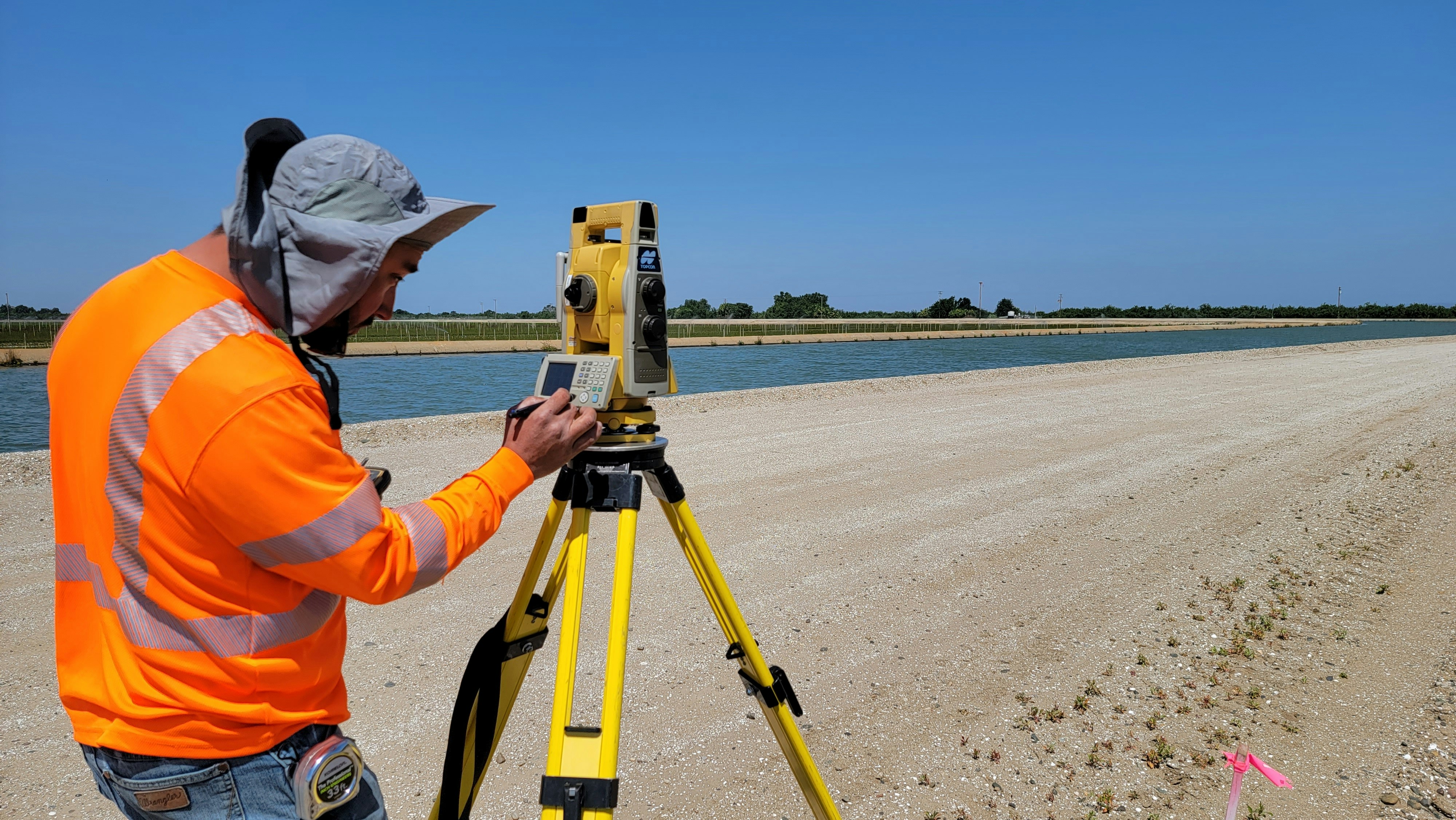
A topographical survey is a measured plan of the site as it exists, tied to a datum so that every height on it can be compared with every other height.
A competent one will usually capture:
- Spot levels across the site and contours at a stated interval, related to Ordnance Datum or a clearly marked site datum
- Boundary features as built: fences, walls, hedges, changes of surface, kerb and channel levels in the road
- Building footprints, with eaves and ridge heights of your property and the neighbouring ones that matter
- Trees, with position, trunk size and canopy spread, which is what an arboriculturalist needs for a BS 5837 survey later
- Visible service evidence: manhole and inspection covers, invert levels where they can be lifted safely, gullies, overhead cables, meter boxes
- Hard landscaping, steps, retaining walls and any level change you will have to design around
The point of all this is the vertical dimension. Anyone can measure a garden’s length. Knowing that it falls 1.4 metres from the house to the rear boundary, and where, is what changes a design.
When the Council Will Expect One
Validation requirements in England come from two places. There is a national list, and there is a local list published by each planning authority under article 11 of the Town and Country Planning (Development Management Procedure) (England) Order 2015. National policy says those requests must be relevant, necessary and material to the application, and local lists are meant to be reviewed at least every couple of years.


Read your borough’s list before you draw anything. Most contain a line very like this: existing and proposed site sections and finished floor and site levels, required where the site slopes or where ground levels will change.
In my experience the schemes that reliably trigger it are:
- Sloping sites: Any garden with a noticeable fall, front to back or side to side.
- Basements and lower ground floor extensions: Several London boroughs have their own basement policies and want sections, levels and a basement impact assessment, not sketches.
- New build plots and infill: Finished floor levels, access gradients and drainage all have to be justified.
- Flood risk areas: A flood risk assessment needs finished floor levels expressed against Ordnance Datum, which means someone has to go and measure the ground.
- Sites with trees or shared boundaries under pressure: Root protection areas and daylight assessments both depend on accurate positions and heights.
Councils will also ask for one at pre-application stage if the officer cannot follow your drawings. That is usually a hint worth taking.
What Goes Wrong When the Levels Are Guessed
The first failure is invalidation. If a required drawing is missing, the application is not registered, and the statutory clock does not start. That clock is eight weeks for most minor applications and thirteen for major ones, so a fortnight of back and forth over levels is a fortnight added to the front of the process, not absorbed by it.
The second failure is worse, because it survives validation. Drawings based on assumed levels get consented, and then the setting out on site does not match the approval. At that point you are choosing between building something you have not got permission for and applying to vary the consent.
The third is the permitted development trap. Under article 2(2) of the General Permitted Development Order 2015, where the level of the surface of the ground is not uniform, height is measured from the highest part of the surface of the ground adjacent to the building. On a falling site, that single line has decided a lot of arguments about whether a rear extension needed permission at all.
And since England scrapped the free resubmission in December 2023, a refused application no longer buys you a second attempt at no charge. The householder fee alone is now in the hundreds of pounds, and it is not refundable whichever way the decision goes.
Briefing a Surveyor: Ask for Deliverables, Not “A Survey”
Here is where money gets wasted. Somebody orders “a topo”, receives a PDF, and then the architect discovers there is no CAD file, no section, and no levels beyond the boundary, so the ridge height of the neighbouring house has to be guessed anyway.
You must specify the output before anyone books a day on site. This includes:
- A 2D CAD file (DWG or DXF) plus PDF, plotted at 1:100 or 1:200, with the drawing origin and datum clearly stated
- Spot levels at an agreed spacing and contours at an interval you actually need, typically 0.25m or 0.5m in a garden
- At least two site sections, one along the slope and one across it, extended to include adjacent buildings
- Neighbouring eaves, ridge and window positions where overlooking, daylight or matching eaves lines will be discussed
- A written note of the survey control, the accuracy band worked to, and the agreed extent of survey marked on a plan
On accuracy, the reference document is the RICS professional standard on measured surveys of land, buildings and utilities, third edition, which works in survey accuracy bands rather than one blanket tolerance. Agree the band in writing. It is the difference between a plan good enough for a planning drawing and one good enough to set out a retaining wall.
Cost and timing are less mysterious than people expect. Published cost guides put a standard residential plot in the region of £800 to £1,200 plus VAT, with London at the upper end because of travel, access and parking, and most small sites need about a day on site and a day drafting.
If you are commissioning a topographical survey in London, it is worth reading how the established firms describe their scope. Terrain Surveys, who have been doing land and measured building work since 2004, list theirs in the sort of detail worth copying into your own brief: topographical surveys, measured building surveys, utility and GPR work, and 3D laser scanning. Having all of that under one team saves a second mobilisation when the drainage strategy suddenly needs underground services too.
Topographical, Measured Building and Utility Surveys Are Three Different Jobs
They get confused constantly, usually at the point where an invoice arrives for something you thought was included.
A topographical survey maps the outside: ground, levels, boundaries, external features.
A measured building survey maps the inside and the fabric: floor plans, elevations, sections, internal heights. Convert a loft or reconfigure a flat and this is the one the drawings are built on.
A utility survey locates what is buried, using electromagnetic detection and ground penetrating radar, and is specified against PAS 128:2022 quality levels from D, a records search, up to A, verified by exposure. Worth doing before you design a basement or a foundation next to an incoming main.
Ask which of the three you are buying. Then ask whether the deliverables will sit in one coordinate system, because that is what lets your designer overlay them.
If Permission Is Refused Anyway
Start with the decision notice rather than the appeal form. If the reasons are about missing or unreliable information, that is fixable and a revised application is usually the faster route. If the reasons are about principle, height, mass, overlooking or policy, no amount of extra survey work changes the answer.
Appeal windows are tight: twelve weeks from the decision for householder appeals in England, six months for most other applications. Appeals are decided on the same policy that produced the refusal, and they take months, during which the site still costs you money in interest, insurance and council tax.
Which is the moment some owners conclude the scheme is simply dead. An inherited house that only stacked up with a loft conversion, a plot bought on the assumption of a basement, a probate sale where nobody wants to fund an appeal.
If that is where you have landed, selling as it stands is a legitimate option rather than a defeat, and worth pricing against the cost of fighting on. Cash buyers such as Property Rescue, a founding member of the National Association of Property Buyers and a member of The Property Ombudsman, will sell the property fast in a matter of weeks with no viewings and no chain.
Go in knowing the trade off: speed and certainty are paid for with a discount to market value, so compare any offer with what an estate agent sale would net you after fees, time and the risk of the buyer walking.
Conclusion
No, a topographical survey is not a legal requirement for planning permission. But on a sloping site, a basement, a new plot or anything where a level change has to be justified, your local validation list will ask for levels. Guessed levels then fail twice: once at registration, and again on site when the setting out does not match the approval.
So the question is not whether you are obliged to commission one. It is whether your drawings can prove what the ground actually does. Get the ground measured before the design is fixed, not after the council has told you the drawings do not add up.