



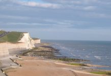












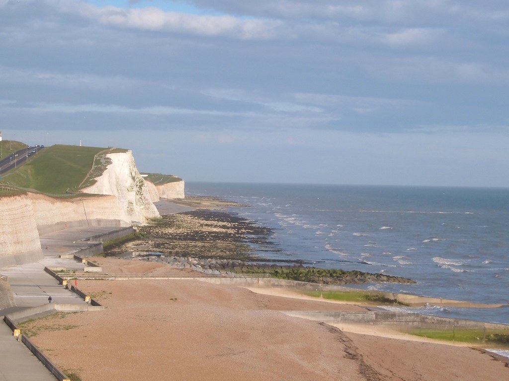


On a bright morning, the Undercliff Walk is one of the best things about living in Brighton. Runners, cyclists and dog walkers follow the sea wall for about 4.5km from Black Rock to Saltdean, with white chalk cliffs on one side and open sea on the other. By Nick Staunton.
Every few winters, though, the cliffs remind everyone that they are on the move. In January 2023, the council closed the path after what it called “constant and significant chalk fall”. A cyclist told Brighton & Hove News it was “raining rocks”. Two years earlier, the coastguard warned of daily falls at Saltdean. The walk has also been shut for long periods in 2000–01 and 2012–13.
So what is happening to these cliffs, what is being done about it, and who pays?
Why the Cliffs Keep Falling
The cliffs between Brighton and Newhaven are soft chalk, laid down on the seabed millions of years ago. They are so important that they have been a Site of Special Scientific Interest since 1986, prized for their fossils and geology.
Chalk is attacked from two directions. At the base, waves batter the cliff, especially where there is little beach to absorb their energy. On the face, rain soaks in, freezes and expands in cold snaps, and wind strips away loose material. That is why falls often follow wet, freezing weather.
The wider picture is not encouraging. A 2016 study of Beachy Head and Seaford Head found that cliffs which had retreated by just 2–6cm a year for thousands of years were now losing 22–32cm a year. The researchers blamed thinning beaches, which leave the chalk more exposed to waves. As Dr Dylan Rood of Imperial College put it: “Cliff erosion is irreversible; once the cliffs retreat, they are gone for good.”
The Wall That Holds Them Back
Between the Marina and Saltdean, the sea no longer reaches the cliff foot. The Undercliff Walk opened in 1933, and the sea wall beneath it has protected the base of the cliffs ever since.
That wall matters more than most walkers realise. According to the council’s coastal strategy, it protects the A259 coast road along the clifftop, the main sewer serving Brighton and Hove, which runs inside the cliffs, and gas, electricity and telecoms lines that are important to the national network. It also protects homes in Roedean, Ovingdean, Rottingdean and Saltdean.


The council’s long-standing policy for this stretch is to “hold the line”, meaning it keeps the defences where they are. East of Saltdean, where the cliffs are unprotected, the policy is to let nature take its course. That is why the cliffs towards Peacehaven continue to retreat.
What Is Being Done
The wall stops the sea undercutting the cliffs, but it cannot stop the face weathering. So the council also manages the cliff itself.
In 2023, specialist contractors abseiled down a 30-metre cliff face to remove loose chalk and flint by hand over about 5,000 square metres. The work, carried out by CAN Geotechnical for the council, paused for the bird-nesting season and resumed with a six-week closure between Roedean and Rottingdean before Christmas. Engineers also carried out a detailed inspection of the chalk to judge the risk to walkers.
Removing loose rock prevents bigger falls and keeps the slope at a stable angle, which slows erosion. But it is maintenance, not a permanent fix. As long as the weather keeps working on the chalk, the falls will continue, and the path will close from time to time.
What It Will Cost
The council’s strategy for this coastline split the 4.4km between the Marina and Saltdean into four sections. Its 2001 assessment valued the cost of defending them over 50 years at about £10m, against roughly £33m in benefits from the road, sewer, utilities and homes protected.
The weakest point was the oldest. The stretch from the Marina to Ovingdean, which carried more than three-quarters of the total cost, was described as close to the end of its life, held together by repairs.
Those figures are now 25 years old and will have risen sharply with inflation and construction costs. We could not find a recent published estimate for rebuilding the eastern defences.
For comparison, the council’s separate scheme to protect the coast between the Marina and the River Adur in Hove saw funding for its next phase raised from £6.5m to £11m last year. Coastal defence is expensive, and much of the money depends on national grants, which councils compete for.
What Comes Next
Climate change makes the challenge harder. Higher sea levels and stronger storms mean more waves overtopping the wall and more stress on old concrete. Wetter winters mean more rain soaking into the chalk.
For residents, the questions are practical. How long can the 1930s wall last? When will the oldest section be replaced, and who will pay? And how often will one of Brighton’s best walks be closed?
Brighton Local
If you use the Undercliff Walk this winter, keep to the path, obey any closure signs and fencing, and avoid lingering directly below the cliffs after heavy rain or a hard frost. When the path is closed, the Rottingdean Ramp and the Saltdean subway usually still give access to the beach and the cafés. The cliffs are one of the city’s great sights, and they are also one of its most changeable.
Related Reading
- Brighton’s Seafront Is About to Change
- Government Backs Brighton Beaches With New Funding
- Places to Visit Near Brighton: Day Trips, Villages & Coast